The dome will be in the walk-in area, to avoid the noise, congestion, and dust of the main camping area. I’m bringing a 4-foot by 7-foot garden cart to allow easy transportation of equipment from the road to the camp.
But now the question is, just where in the walk-in area should we be?
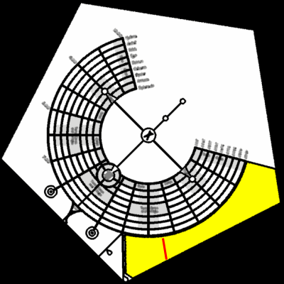
Here’s a diagram of Black Rock City, with North pointing up and the walk-in area in yellow. I’ve put a red line on the diagram that indicates the size of a particular pair of roads in Sunnyvale California that I’m familiar with. This line is 1/4 mile long.
Here’s a closer look, with a photo of those particular roads overlayed. The “4:00” in the diagram is the name given one of the radial roads in Black Rock City. (The city is rotated by 45 degrees relative to North, and so 4:00 is not where you’d expect it to be on this map. In Black Rock City, road 4:30 points directly South.)
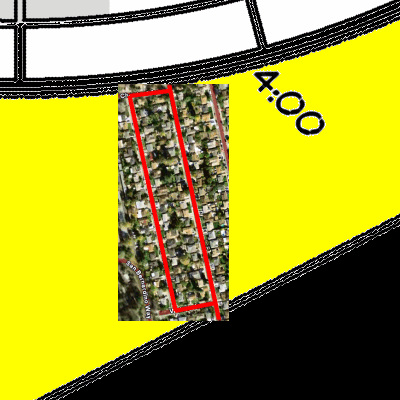
Being about 2/3 of the way down the red line is one possibility for the camp location. The wide road at the top of the diagram has a lot of traffic, and the rest of Black Rock City is North of that. The road at the bottom has only occasional traffic, being a service/security road. The airport runway is about 1/4 mile South of the service road.
Another possibility is locating to the right on the other side of 4:00, again, about 2/3 of the way down the line. In either case, we want to be upwind of the porta-potties, which probably are at 3:30.